ISR Orchestration
Since 2006, Riverside Research has applied novel algorithms and automation to support ISR Orchestration. Across a wide variety of phenomenologies, our customers use our Collection Planning Suite (CPS) and Enterprise Collection Planner (ECP) solutions to optimally allocate collections from a rapidly expanding and varied set of satellite and airborne sources respectively to address critical intelligence needs and maximize the intelligence value of each collection. Our multi-level security classification solutions capitalize on emerging capabilities such as evolving global coverage, rapid revisit rates, varied spectral content, and growing analytic capabilities. No other company offers our unique blend of nonprofit status, R&D culture, and depth of understanding in ISR Orchestration.
Measurement and Signature Intelligence (MASINT)
Prior to MASINT becoming a formal intelligence discipline in 1986, Riverside Research supported a wide range of MASINT operations, analysis, and advisory activities across numerous defense and intelligence organizations. To this end, Riverside Research provides Mission Assurance and R&D professionals focused on accelerating capability development to address our nation’s most vexing problems spanning counterproliferation, counterdrug, counterterrorism, weapon advancements, and other strategic and tactical missions.
Setting the standards, literally
We serve the MASINT community by setting the standards that can mean the difference between mission success and catastrophe. Our experts analyze new MASINT sensors to develop and publish standards for sharing and exchanging their product information. These standards are key to achieving interoperability between the varied set of MASINT data providers and the worldwide set of consumers.
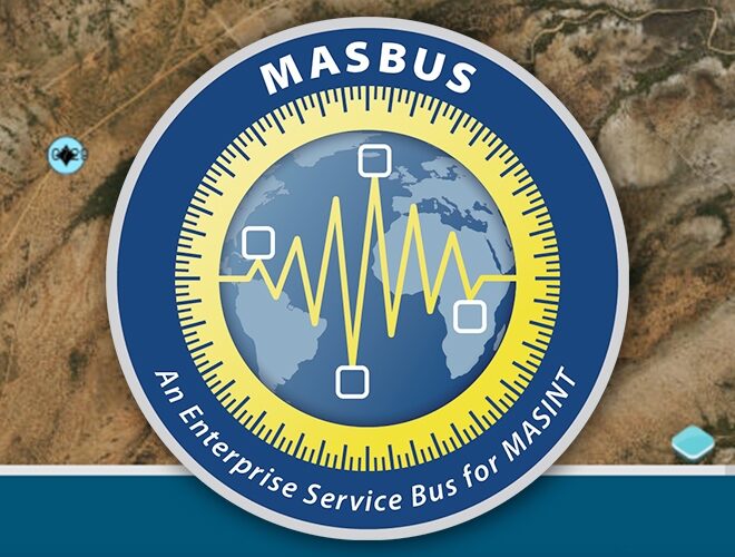
Our team also supports the evolutionary development of the Measures and Signatures Intelligence Enterprise Service Bus (MASBUS) to address the issue of integrating disparate systems at the edge in NATO and bringing curated data into the NATO ISR architecture. This further improves the effectiveness and survivability of coalition operations.
Geospatial Intelligence (GEOINT)
Well before then NGA Director James Clapper formally christened the term GEOINT in 2003, Riverside Research was providing a wide range of innovative and reliable GEOINT information and solutions across many defense and intelligence organizations. Our experts provide Mission Assurance and R&D professionals focused on advancing all GEOINT phases—from collection tasking to product dissemination for all phenomenologies—to transform how we assess, describe, and visually depict physical features and geographically referenced activities on the Earth.
Our ISR experts recognized the need for rapid innovation to improve the utility of commercial GEOINT solutions against our challenges, so we established the Commercial Innovation Center (CIC) to bridge the growing gap between the commercial GEOINT providers, analytical providers, and operational USG enterprise.
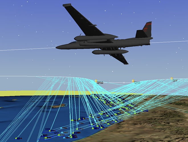
ECP and CPS
Riverside Research has developed a Collection Planning Suite (CPS) and an Enterprise Collection Planner (ECP). Our CPS provides modeling and simulation environments for space-based GEOINT, complete with automation and currently used by the National Geospatial-Intelligence Agency (NGA). Our ECP automated mission planning tool provides mission planners, sensor operators, and target analysts with the ability to generate aircraft route and sensor plans based on threats, terrain, and other real-time data.